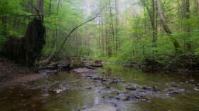
The Floyds Fork waterway stretches about 60 miles through five counties, feeding into the Salt River in Bullitt County. It’s one of the biggest natural attractions in Louisville, supported by a popular parks system that debuted more than a decade ago.
However, some residents are worried about how development near Floyds Fork impacts its health and what lies ahead in its future.
This isn’t a new concern. In 1993, after years of local efforts promoting waterway protections, county leaders approved a Development Review Overlay District around Floyds Fork. The district regulations, which the city says covers more than 13,000 acres, is part of the city’s expansive Land Development Code.
Now city planners are working to update the district’s rules for the first time. Louisville Metro Council ordered planners in mid-2022 to revise the regulations, using a Floyds Fork vision plan the body approved in 2020.
The city’s current revisions include increasing buffer areas restricting development close to Floyds Fork and other area waterways. They would also specify which types of development applications can be reviewed by Planning and Design Services, and which have to be elevated to the Planning Commission for consideration.
The draft also requires the city to commission environmental assessments for certain waiver requests, such as altering the buffers, paid for by the applicant.
Brian Davis is the assistant director for Louisville Metro’s Department of Planning and Design Services, and the case manager for the Floyds Fork district changes. He said work on the regulations — meant to be finalized more than a year ago — has taken a hit from staff turnover and other directives, such as updating short-term rental rules.
“We've had other Land Development Code items that Metro Council has sent our way, that have kind of taken priority over this particular one,” Davis said.
Planners are on their third draft of revisions, after completing their initial draft last summer. The city’s Planning Commission will have to decide whether to recommend that Metro Council approve the changes submitted by planners.
At a public hearing held by the commission on Thursday, workers and residents from the development and environmental preservation communities said they weren’t satisfied with planners’ proposed regulations. The commission members could vote on the proposal at their March 7 meeting. They decided to give the city more time to make updates based on public feedback.
“It's [about] trying to come to an agreement about what is best overall for the community, and not necessarily just the Floyds Fork corridor,” Davis said.
He noted that he’s especially heard from preservationists. That community includes the Floyds Fork Coalition, made up of local neighborhood and advocacy groups. In a letter to the city, they said the proposed changes don’t go far enough, and recommended ideas they believe would better protect the waterway.
Among their concerns, the coalition said buffer protections need to be stronger and apply to more waterways connected to Floyds Fork. They also argued against shortening the allotted time for the city to review development applications.

Lucas Frazier founded Louisville Keep Your Fork, a nonprofit advocacy group that signed on to the letter. He said erosion is rapid along Floyds Fork. He and his family have lived next to it for about a decade, in a house he said was built about 70 years ago, before modern regulations.
He said he began noticing drastic changes about three years ago.
“All of a sudden, that four-inch rain is having a much larger impact than it did the year before,” Frazier said.
He said he thinks the city is doing important work to address concerns, but doesn’t believe the proposed changes are in good shape.
Take the recommendation to ban excavating on the floodplain near the waterway: Frazier supports that change, but disagrees with the option to bypass it through a waiver.
He said rules need to lean toward preservation rather than development.
“You're not going to tear down neighborhoods to plant trees and reintroduce wildlife,” Frazier said.
In its letter, the coalition also said current proposed rules for preserving trees and limiting impervious surfaces don’t do enough to limit and filter water runoff into Floyds Fork.


